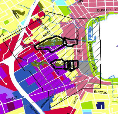
Here is a site diagram from Barrie's Planning Act.
No mention is made of the time frame the site was used for waste disposal.
The Allandale Community and the Allandale Station Lands lie within this area shown with the hash marks.
Below is the Lake Simcoe Watershed map which also emcompasses the Allandale Community and Allandale Station Lands.
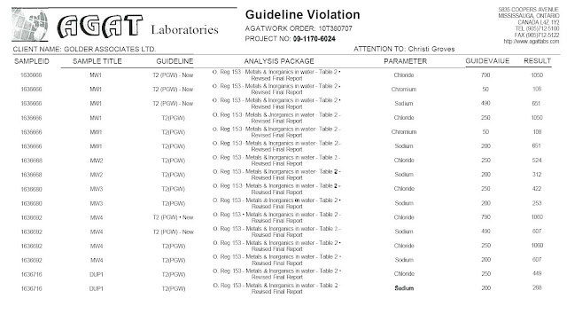
Below is a chart from one of the Golder Reports. Notice their comment about possible fill placement.
Notice also that they are primarily looking for metals.
Golder in its report makes particular note about their Health and Safety concerns when working at Allandale.


No comments:
Post a Comment